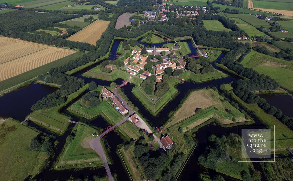
Today this is a village, with 133 houses and fewer than 300 inhabitants. Yet Bourtange was built as a military fort in 1593, during the Dutch Revolt, on the orders of William the Silent. It held this role until 1851, when it officially lost its defensive function and became populated by craftsmen and farmers. Its initial purpose was to guard the road linking Spanish Groningen to Germany. It is one of the most spectacular star-shaped forts in Europe. The pentagonal plan and its network of canals and fortifications respects the original project. The square stands in the geometric middle and follows the pentagonal shape of the buildings placed within the fort. Its perimeter is perfectly defined by 14 lime trees which are over 300 years old. The square holds the most important houses: the captain’s house, the commander’s house, and the house of the school headmaster, for the placement of its buildings was hierarchical. The Protestant church dates from 1869 and, notably, is situated close to the square but not within the square itself.