Piazza Pio II from Pienza, Italy

Perched upon a hilltop in Tuscany, Pienza was originally called Corsignano. Pope Pius II loved his hometown greatly and wished to transform it into a concrete illustration of his theories about the “ideal city.” For this purpose he hired the architect Bernardo Rossellino and was himself directly involved in the city’s planning. Influenced by Alberti’s writings, Pius wished to build a uniform and self-sufficient city around a central square. Yet when he died in 1462, the urban sketch of the city that had taken his name was stopped, with only 40 completed buildings. At the heart of this “ideal city,” Bernardo Rossellino had managed to install a trapezoidal square, representing one of the first attempts of urban renewal in the postclassical period.

The area is not large, yet the illusion of space is created through its shape and the design of the pavement. The overall effect is that of a stage set flanked by important buildings. The Palazzo Vescovile lies on the eastern side of the square. On the opposite side stands the Papal Palace. The City Hall lies to the north, with a Florentine-style tower chosen by Rossellino. Two other buildings complete the northern side next to the City Hall. The square is dominated by the façade of a Cathedral, built along the smaller side of the trapezoid, so as not to end up overwhelming the square, for the Pope wished to build a city of human, rather than monumental, dimensions. Everything was carefully calculated, with the construction of the church even taking the movements of the sun into consideration. Inspired by Austrian Cathedrals that were bathed in natural light, the Pope asked that this church not respect the traditional east-west alignment, but be set in such a way that the sun would pour in from the southern windows. The church is aligned with the top of Mount Amiata, an extinct volcano. Its peak is visible from the southern windows of the church, though it is not visible from the square. This leads to an interesting reversal of perception: the interior of the church feels like a wide space that opens out to the landscape, while the square allows little access to its surroundings, and instead feels like an interior space. The two narrow open areas inside the square, on either side of the Cathedral, are some of the earliest Renaissance examples of visual access to rural landscapes from within a town. As such, it diverges from traditional medieval squares. In order to see the landscape, one must arrive at the very end of the square.

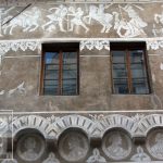
Within the square, various details from one building’s façade reappear on another façade; the rectangular shape of these façades recreates the shapes of the windows to scale. The windows at the upper level of the Papal Palace are Rossellino’s inventions, a combination of the Roman cross and the Tuscan rose window. The cross reappears as a detail on the windows of the Palazzo Vescovile, and the rose window reappears on the City Hall’s windows. Archways and circular details, grouped in threes, repeatedly appear on the façade of each building, The travertine grid and the red brick pavement mirror the series of compartments on the façade of the church, and are aligned with the pillars, doors, and corners of all of the buildings found along the square. At the centre of the square is a travertine circle, and the distance between the circle and the door of the church is equal to the distance between the base of the church and the occhio, a typical round window on the façade of the church. This is not the only “coincidence,” for the square respects a geometry based on the numbers 3, 5, and 9.  Moreover, in the early 2000s it was found that the shadow of the Cathedral aligns perfectly with the grid of the pavement at particular moments in time—specifically, 11 days after the solar equinox. It was known as early as the 15thcentury that there was an 11-day difference between the civil calendar and the astronomical one. The calendar reform was highly controversial within the Catholic Church, since Easter is calculated according to the equinox. Pieper, who observed the alignment of the church’s shadow with the grid, believed that the square was initially intended to demonstrate this on the day of the equinox. Thus, the construction had begun, but the project was adjusted so that the alignment would take place on the exact day of the equinox. When the modification was decided, construction on the square’s buildings was already underway. Redrawing the pavement grid would have led to discrepancies in the buildings’ details, so a solution was found by raising the roof of the Cathedral. This has been confirmed by evidence that the Albertian proportions on the church pediment have not been respected. It is still a mystery why details of this reconstruction, as well as the story of the alignment of the Cathedral’s shadow with the drawings on the pavement, make no appearance in the Pope’s extremely detailed diary.

Piazza Castello from Marostica, Italy

Every other year, in the second week of September, Marostica hosts a game of chess. But in this game, living people play the roles of the wooden figurines, and the square of this tiny medieval town serves as the chess board, with its pavement designed especially for this purpose. For this reason, the Maroustica Piazza Castello is also called the Piazza degli Scacchi. As the story goes, in medieval times, two young nobles, Rinaldo D’Angarano and Vieri da Vallanora, fell madly in love with Lionora, the daughter of a local Lord. The customs of the time required that the girl’s fate be decided through a duel. But as her father did not wish to make enemies, and wanted no blood spilt, he forbid the duel and proposed a chess game in its stead. The winner would become the husband of the coveted Lionora. The loser would not lose, but instead gain the hand of his younger daughter, Oldrada. Of course, this story has no basis in historical fact. Not one of its characters ever existed, just as there was no chess match in medieval Marostica, which in the local Venetian dialect was called Maròstega. A Dalmatian writer and architect named Mario Mirko Vucetich invented the entire story, just after the Second World War. And the local chess club found it apt to regard the story as true and to organise, every other year, a competition with living people as chess pieces, in this scenic square with medieval origins in the small town of Marostica, in northern Italy.

Braşov, Romanya, Piața Sfatului

11. yüzyılından itibaren, Braşov’daki Piata Sfatului’da sürekli olarak ticaret amacıyla pazarlar düzenlenirdi ve çeşitli ürünlerin değişimi yapılırdı. O zamanlarda, ismi Marktplatz idi. Bölge, 1420 yılında inşa edilen Casa Sfatului Binası, meydana hakimdir. Açık rengi sayesinde, bina sadece meydanın merkezini değil, yakınlarda bulunan, meydandan görülebilen siyah kilise Schwarze Kirche, Biserica Neagră sayesinde ilginç bir renk kontrastı da sunmaktadır.


Žižkovo náměstí from Tábor, Czech Republik

One one side of this square is a statue of Jan Žižka, leader of the Hussite movement, and one of the few military commanders in history to have never lost a single battle. Today, his name is found in this square in Tábor. Situated on a hilltop, with the square at its peak, and near Lake Jordan, named after the Biblical river, this city was founded in the spring of 1420 as a centre of the Hussite revolutionary movement. At first carefully planned, it later developed organically, and the shape of its square points to this tendency. Its streets were intentionally designed in zigzag formation, so that enemies would have difficulty reaching the centre. Although it is hard to see in the photograph, the square is sloped, which gives it an additional spatial dimension.

Lizbon, Portekiz, Praça do Comercio

Meydan, varlığını 1 Kasım 1755’te Lizbon’daki büyük deprem ve doğal afetlerin boş bıraktığı yerde çıkan yangına borçludur; yeni ve düzenli bir şehir inşa edilmiş, kraliyet hükümetinin yöneticisi olan Markiz Pombal tarafından koordine edilen kurtarma çabalarının sonucudur. Praça do Comercio, meydan için hala kullanılan bir isim olan eski Terreiro do Paço sarayın avlusunda bulunmaktadır. İber Yarımadası’nın en büyük nehri olan Tejo’ya açılan bir yönde, oldukça işlek bir noktada yer alıyor. 175 x 180 metre genişliğinde olan meydanın yüzeyi, Avrupa Kıtası’nın en büyük meydanlarından biridir.

Plaza de la Corredera from Córdoba, Spain

Soon after the Plaza Mayor was built in Madrid, its design was copied by other cities, even ones very distant from the capital. The Plaza de la Corredera in Córdoba is the only quadrilateral square in the south of Spain and Andalusia, developed by the architect Antonio Ramós Valdés of Salamanca. In 1683, on the site of an esplanade, which historically had been a Roman circus, and subsequently a trading area during the city’s Muslim era, he constructed a giant, semiregular quadrilateral, slightly smaller than the one in Madrid.

After it was built, the square was used for various purposes, serving as the grounds for temporary trade fairs and an arena for corridas, from which its current name originates. In the area beneath its ground floor arches are the so-called esparterías shops that sell traditional objects braided from plant fibres. Antique shops have existed here for nearly a century.

Domplatz from Passau, Germany

This urban structure was determined by its geographical position, one of the most spectacular in urban Europe. Passau is situated on a spit of land, at the confluence between the Danube, the Inn and the Ilz, each with differently coloured waters. The Domplatz lies at the highest point of the city, which serves to its advantage, as Passau is threatened by floods each year. The square was built in 1150, and in 1155, after donations by the Bishop Konrad von Babenberg, it became the property of the Cathedral, under the condition that clerical houses be built on its free sides. These 14 buildings were damaged by the great fires of 1662 and 1680, and then rebuilt by Italian architects in a late-Baroque style. In 1824, a statue of Emperor Maximilian I of Bavaria was placed in the square. Thus, for the first time in its history, the square became public, gaining the status of an official town square. It was renovated after 2013. Its pavement was replaced with fine gravel, pointing to its previous historical eras. Its lighting is spectacular, one of the finest in Europe. Highlighting the façade of the Cathedral, leaving the square and the rest of the buildings in half-light, it enngages in a subtle game of darkness and light, linking the past, when cities did not have public lighting, with the future. The effect is that of a scene from a Baroque play.


İstanbul, Türkiye Sultanahmet Meydanı

Meydan alanı, Doğu ile Avrupa arasındaki buluşmanın bazı belirsizliklerine sahiptir. Söz konusu tek bir meydan değildir, aynı adı taşıyan iki birleşik meydan var. Resmi adı Sultanahmet Meydanı olmasına rağmen, Ayasofya ile Mavi Camii olarak bilinen Sultan Ahmet Camii’nin arasında, genellikle Ayasofya Meydanı olarak adlandırılan ve ortasında bir çeşmesi olan bir meydan bulunmaktadır. Roma döneminde Augusteion ismindeki Augustus’un Foru olduğu yerde bulunan bir bahçe meydanıdır. Paradoksal olarak, tam anlamıyla park olmamasına rağmen Sultanahmet Camii ve İslam Eserleri Müzesi arasında bulunan uzun meydanın ismi Sultanahmet Parkı’dır, kaldı ki yanında bulunan meydanın parkı çok daha büyük. Dünyada başka hiçbir yerin metrekare başına bu kadar çok fazla tarih bulundurmuyor. Büyük Teodosis’in Dikilitaş’ı aslında Mısır’dandır ve buraya Luksor’dan 390 yılında getirildi. Assuan Granit’te oyulmuş ve 1490 yılında Mısır firavunu III. Tutmes anısına dikilmiştir. Serpantin sütunu ise, Perslere karşı Yunan zaferinin anısına Delphi Apollon tapınağıdan 324  yılında getirildi. Şimdi 2500 yaşında olan bu serpantin sütunu, yunanlıların ellerine geçirilen Fars silahlarının eritilmesinden elde edilen alaşımdan kalıplanmış. Başka bir dikilitaş, onuncu yüzyılda Konstantin tarafından inşa edildi. Bunlara, İmparator II. Wilhelm’in ziyaretin anısına 1900 yılında inşa edilmiş olan bir “Alman Çeşmesi” eklenmektir. Doğu Roma İmparatorluğu’nun sıfır kilometresi, meydanın kuzeydoğu köşesinde hala görülebilen bir mermer sütunuyla işaretlenmiştir. Dahası var. Meydan, aslında Roma Hipodromun arenasıdır.

Split, Hırvatistan, Trg Peristil

Eski Split kente yukarıdan bakıldığında, birinin bina, sokak ve meydanlar yerleştirdiği dikdörtgen bir kutu gibi görünüyor. Split’teki meydanların en ilginç ve en eskisi, Trg Peristil’tir ve yerel halk tarafından yerin tarihi kalbi olarak sayılmaktadır. Meydanın tarihi, oldukça özeldir. Başlarda meydan, 305 yılında Roma İmparatoru Diocletian için inşa edilen, 300 metrekarelik devasa bir alanı olan sarayın iç avlusuydu. Aslında, eski Split kentin yarısı sarayın surları içinde yer almaktadır ve günümüze kadar en iyi korunmuş Roma sarayıdır. Romalılar onu terk ettikten sonra, Slavlardan korunmak amacıyla Salona sakinleri duvarlar arasına yerleşip eski sarayı şehre dönüştürene kadar yüzyıllarca terkedilmiş şekilde kalmıştır. Daha sonra hep şehir olarak kalacaktır. Mekanın ilk başpiskoposu olan Ravenna, Diocletian’ın mozolisini bir kiliseye dönüştürmeye karar verir. O andan itibaren saray avlusu, bir ortaçağ meydanın tüm işlevleriyle birlikte, resmi olarak katedralin meydanı haline gelmektedir. Dönüşümlere uğrar, ancak kırmızı porfir sütunları da dahil olmak üzere, bir takım parçaları korunur.

Rovinj, Hırvatistan, Trg Sveta Eufemije Trg G. Matteottija

Kentin tarihi Venedik’e bağlıdır ancak Rovinj, dar kanal tarafından anakaradan ayrılmış bir adada sekizinci yüzyılın başında, yani biraz daha erken kuruldu. Çok daha sonra, 1763 yılında, Venedik yönetiminin sonuna doğru, topluluk kıyıları tıkayarak adayı şehirle birleştirir. Eski kanalın bulunduğu yerde, klasik bir synoikisis süreciyle birlikte, çok kısa bir zaman içerisinde dört meydandan oluşan ve aralarında en önemli Trg G. Matteottija olduğu bir meydan sistemine dönüşür. Burada bulunan binaların çoğunu on dokuzuncu yüzyıla aittir, fakat geçmişte Venedikle olan bağlantılarını yüceltmek adına Aziz Mark’ın aslanı bile yapılmış ve belediyenin önüne yerleştirilmişti. Şehirin Anameydanı, tepenin en yüksek noktasında bulunan Trg Sveta Eufemija’ dır. Bazilikanın 60 metrelik çan kulesine hakim, üç tarafı deniz ve yanları boş olan, tepesinde Aziz Euphemia heykelinin rüzgarın yönüne bağlı olarak döndüğü meydan, şehirin en önemli meydanı kalmaya devam etmektedir.

Piran, Slovenya, Tartinijev trg

Tanınmış II trillo del diavolo ‘nun yazarı Giuseppe Tartini, Venedik Cumhuriyeti’nin bir parçası olan ve o dönemde Pirano olarak bilinen bu şehirde doğdu. Piran Meydanı onun adıyla anılır ve bestecinin doğduğu ev meydanın yan tarafında bir yerdedir, ancak onun doğduğu dönemde yerler oldukça farklıydı. Tartini Meydanı her zaman bir meydan değildi, ilk zamanlarda şehir surlarının dışında bulunan Adriyatik sularında balık tutan tekneler ve gemiler için bir rıhtım idi. Daha sonra boğazlar, saraylar ve idari rolleri olan güzel binalar ile sınırlanmaya başlar. Yer önem kazandıkça, yetkililer 1894’te körfezi tıkayarak kelimenin tam anlamıyla bir meydan inşa etmeye karar verirler. İki yıl sonra, meydanda Tartini’nin heykeli açılır ve Venedik’teki benzer bir çan kulesiyle, Aziz Georgi Kilisesi’nin şapelinin hakim olduğu meydan, şekil ve oranların başarılı bir denge ile uyum içerisinde bulunduğu çok canlı bir alana dönüştürülür.

Ljubljana, Slovenya, Presernov trg, Mestni trg

Presernov trg, günümüzde bile var olan, 1646 yılında bir Fransisken manastırı yapıldığı ortaçağ kentinin girişinde bulunan sıradan bir yol kesişmesiydi. Ondokuzuncu yüzyılda, bu geçiş asfaltlanır ve bir şehir meydanı görünümü kazanır. Aynı yüzyılın sonunu radikal bir dönüşüm getiriyor çünkü, 1895 depremi sonrasında, eski evlerin yerine neoklasik konutlar inşa ediliyor, ardından Sezession. 1980 yılında Sloven mimarı Edvard Ravnikar, meydan kaldırımının günümüzdeki mevcut, onu özel kılan dairesel tasarımı oluşturur: arka planında granit mermer üstünde, rayları Makedon Prilep mermeriden yapılan bir güneş. Ljubljanica nehirin üzerinde yapılan üçlü köprüsü Tromostovje, katredalin yanındaki kale tepenin eteğinde bulunan Stritarjeva ulicayı,  şehirin eski meydanı ile birbirine bağlar. Şehir meydanı Mestni trg, 1751 yıllında yapılan bir çeşmeye hakimdir. İki meydan, sonradan yapılan değişimlere ayrı ayrı uğrayıp ve birlikte tasarlanmamış olsa da, beklenmedik ve oldukça plastik bir meydan kentsel topluluğu oluşturmaktadır.

Hlavné námestie from Košice, Slovakia

Hlavné námestie means Great Square in Slovak, but the early history of this city and its central square is tied to the German colonists who arrived here in the mid-13th century, at the invitation of King Béla IV of Hungary. The city of Košice (Kaschau in German, Kassa in Hungarian, and Cașovia in the old Romanian chronicles), existed at the crossroads of great trade routes linking the Baltic Sea with the Black Sea; Poland with Transylvania; the east of Europe with the south of Europe. Its urban space is rigorously structured. Three parallel roads run from north to south, with the middle road becoming progressively wider until it meets the main east-west artery, forming a special, lens-shaped square. The lens shape is due to the construction of the square in a region that formerly functioned as a trade fair. The trade fair took place in a widened section of the road, halfway between a castle and an abbey, before any other buildings were constructed. The shape also comes from the unification, through a typical process of a synoecism, of two distinct pre-13th century settlements, whose borders were those of the present-day square. At its centre, where these two axes intersect, the German colonists erected a parish church. In the 14th century this church was replaced by the Gothic Cathedral of Saint Elisabeth, the largest Cathedral in Slovakia to this day. The tower of Saint Urban, containing a seven tonne bell, and the Chapel of Saint Michael, both Gothic and built in the 14th century, flank the Cathedral, creating a unique and unitary whole. The theatre, a Neo-Baroque jewel, was finalised in 1899. Gothic houses, Renaissance and Baroque palaces, and Art Nouveau buildings define the perimeter of the square. The contours of the old city walls are clearly visible along the circular paths of the adjacent streets. The lens-shaped square of Košice is the largest and most coherent urban ensemble of its kind, typical of eastern Slovakia.

Telč, Çek Cumhuriyeti, Náměstí Zachariáše z Hradce

1354 yılında, sık bir ormanın içinde, iki yolun geçtiği ve bazı suların hemen yakınında, Moravya, Bohemya ve Avusturya arasındaki sınırda kurulmuştu. Telč, Almanca Teltsch olarak bilinmektedir ve kuruluşundan iki yüzyıl sonra büyük bir yangına maruz kalma talihsizliğine sahiptir.  Eski planı takip edilerek, şehir hızla yeniden inşa edilmiştir ancak yapıları stil ve tekniklerinin gelişimindeki değişimlere uğramıştır. Gotik kale Rönesans tarzında yeniden inşa edilmiştir ve meydanda bulunan bazı evlerin mansart çatıları oluşur ve dış cepheleri değişir; bunlar daha sonra, 18. yüzyılda rokoko yada barok stilini alırlar. Fakat zemin katındaki Gotik tarzlı ortaçağ kemeri hiçbir değişime uğramaz. Kesintisizdir, meydandaki bütün evler onunla birleşiktir. İki kilise daha ve iki çeşme ile çevrili Aziz Joan Nepomuk’a adanan bir veba sütunu da inşa edilecektir. On sekizinci yüzyılın sonlarına doğru, zamanın akışı Telč’te aniden durur ve görkemli dönemi ile ekonomik gelişimi burada sona erer. Şehir, sanayileşmeden hiçbir şekilde etkilenmeden ve sosyalist binalar olmaksızın, halk masallarından oluşan bir kitaptan doğrudan koparılmış mucize bir şekilde günümüze ulaşmıştır. Şehir haritası neredeyse üçgen meydanı ile eşanlamlıdır, bir adım dışarı Bohemia tepelerinin sarımsı kolza alanlarına götürür.